


If you're looking for a perfect summer activity that combines exercise and enjoyment, biking in Boston is the way to go. Rather than giving up your workout plans and settling for a leisurely lunch, hop on an e-bike and embark on a thrilling adventure around the city or on a scenic destination bike ride. Not only will you get a great workout, but you'll also have the opportunity to relax and explore the vibrant surroundings.
To help you get started, we've compiled some great bike routes in Boston. These routes will take you through stunning parks, along rivers, past historical sites, and even picturesque coastal areas. Whether you're a seasoned cyclist or a casual rider, these paths have something for everyone. So grab your helmet, hop on a bike, and get ready to experience the best of Boston on two wheels.
Charles River Bike Path

Photo from Tripadvisor
In Boston, cycling along the Charles River is undoubtedly one of the must-visit routes. Spanning 22.9 miles along the Charles River, parallel to the main road, this route takes you through parks, playgrounds, boathouses, university campuses, docks, and pedestrian bridges. It offers a different perspective of Boston, allowing you to see its unique scenery. Whether cycling or leisurely walking, it's a delightful experience, especially during the sunset.
However, be cautious of your speed while cycling on this route! It can get crowded with pedestrians, joggers, strollers, skateboarders, and fellow cyclists. Pedestrians and other cyclists should exercise caution.
Much of this route extends west of Boston, making it an excellent choice for those living in Waltham. Starting from Waltham and cycling to Cambridge is also a good option.
Many cycling enthusiasts recommend starting from Waltham because the path winds through trees, offering a serene and natural experience. As you continue cycling toward Cambridge, you'll encounter numerous prestigious universities such as Harvard, MIT, and BU. The quiet campuses nestled amidst towering buildings provide a unique and contrasting experience.
Difficulty Level: ★ ★
Safety rating: ★ ★ ★

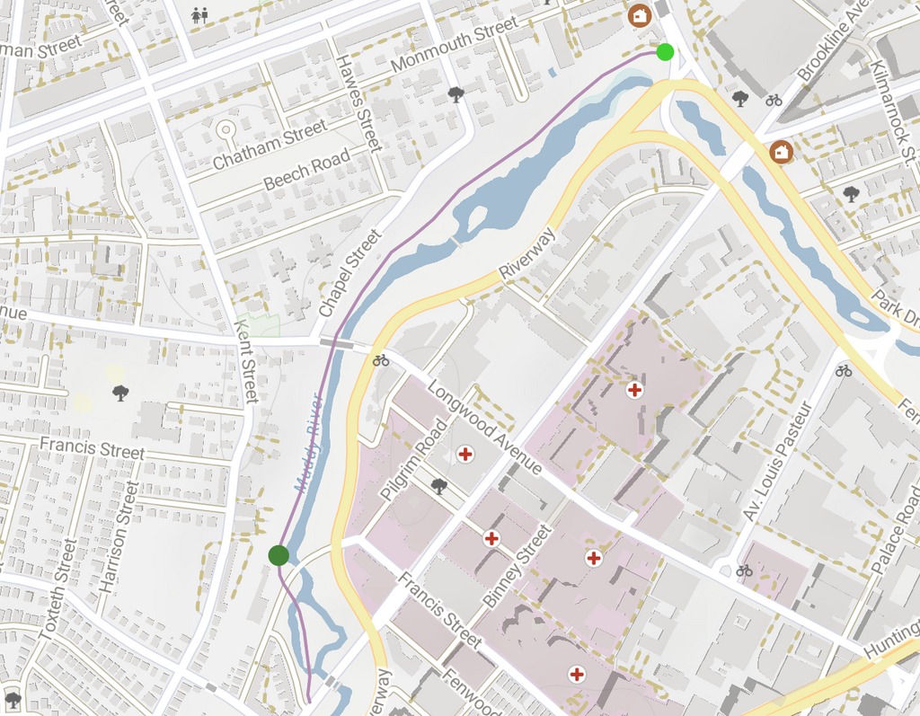
Muddy River Path

Cyclists enjoy the Muddy River Path on the Riverway. LANE TURNER/GLOBE STAFF
The Muddy River Path stretches from Park Drive in Boston to Brookline Avenue in Brookline, near Northeastern University.
It is one of the favorite routes for cyclists in Boston. With tree-lined paths, even riding on hot summer days feels pleasant. When you need a break, you can sit under the trees, enjoying the refreshing natural ambiance.
As you pass through historic stone bridges and vintage streets, you'll be captivated by the beautiful intertwining scenery of towering trees and the serene river. The path's highlights include church buildings dating back to the late 1800s and nearby stone "round houses" pavilions, which exude a nostalgic architectural style reminiscent of stories from the past.
When you need to refuel, plenty of restaurants are nearby, returning you to the urban atmosphere. Recalling the nostalgic streets you just rode through may evoke a surreal feeling.
Difficulty Level: ★ ★
Safety rating: ★ ★ ★ ★
Lower Neponset River Trail

By Pi.1415926535 - Own work, CC BY-SA 3.0,
This bike route in southern Boston is also a favorite among cyclists due to its diverse scenery. Spanning 5 miles from Dorchester to Milton, riders can enjoy views of beaches, salt marshes, historic industrial buildings, railway bridges, colorful murals, and MBTA train cars resting on tracks.
Starting from Pope John Paul II Park Reservation in Dorchester, passing through several parks and under subway lines, you'll reach the expansive salt marshes at the mouth of the Neponset River.
Continuing into Milton, you'll pass through Lower Mills Gorge and encounter historical buildings, including the first water-powered mill in the United States and the Baker's Chocolate factory, established in 1765.
The magical aspect of this route lies in the seamless blend of stunning coastal views with glimpses of urban scenery. The transition from historical buildings to modern skyscrapers creates a sense of journeying through time while riding your bicycle.
Due to its abundance of picturesque views, the Lower Neponset River Trail is one of the most visually captivating bike routes.
Difficulty Level: ★ ★
Safety rating: ★ ★ ★

Lower Neponset River Trail map
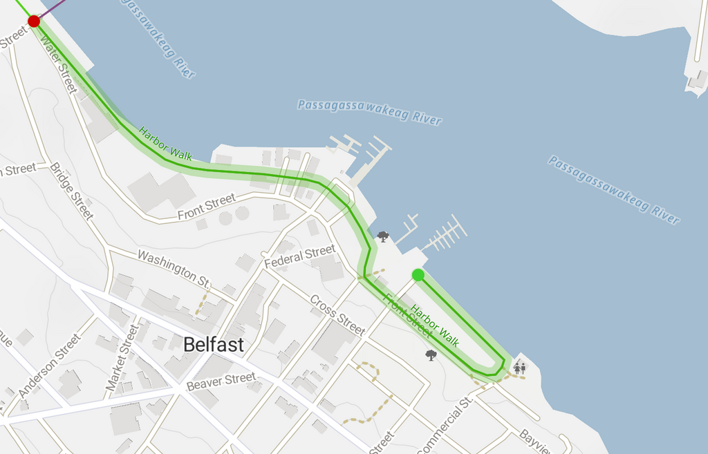
Harbor Walk

Harbor Walk is a bike route that exudes a modern urban vibe. Stretching nearly 40 miles along the Boston waterfront, this path has restaurants, parks, docks, and captivating water views. It's undoubtedly the epitome of luxury when it comes to bike routes!
You can find shared bicycles near the Boston Harbor Hotel, making this a popular starting point for the route.
As you follow the path, you'll notice the endless expanse of water on one side. Ride south along the waterfront, take a left at South Station, and pedal across the bridge. On one side of the bridge, you'll find the Boston Tea Party Ships & Museum; on the other, you'll be near the Boston Children's Museum. These are all famous tourist attractions in Boston.
The recommended biking route extends to Fan Pier Park and the Institute of Contemporary Art (ICA). At this point, your journey with the Blue Bikes ends. You can explore the ICA, take a break at a nearby café for a refreshing beverage (if it's open), or enjoy a stroll nearby.
If you're up for a more extensive adventure, having your bicycle is essential. Keep riding along the Harbor Walk to the southeast, and you'll reach the Harpoon Brewery and Beer Hall near the Bluebikes' Congress Street and Northern Ave stations. Under normal circumstances, savoring a fresh beer while feeling the sea breeze would be a delightful experience.
Difficulty Level: ★ ★
Safety rating: ★ ★ ★